Independently Owned, Locally Grown, Community Loved


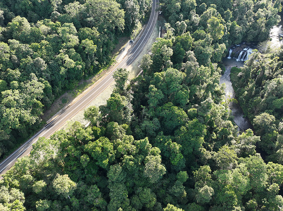
Stabilisation works have been completed on the Palmerston Highway. Photo sourced: Queensland Department of Transport and Main Roads
Reconstruction works jointly funded by the State and Federal Governments through the Disaster Recovery Funding Arrangements (DRFA) have been completed on the Palmerston Highway, a key freight route in Far North Queensland.
Two significant landslips – one where the road sunk two metres and shifted two metres sideways – have been repaired.
The upslope sites, including one that measured 20-metres high and 75 metres at its widest point, were stabilised with more than 6500 metres of soil nails – the length of about 60 football fields – along with high tensile mesh and coir netting.
At the downslope landslip, 83 concrete piles measuring up to 19 metres were installed over 160 metres. A capping beam was built on top of the piles to secure them together. The beam will also act as a retaining wall for the road embankment. The structures used more than 1450 cubic metres of concrete.
Damaged sections of rainforest in the road corridor have also been rehabilitated.
State Member for Hinchinbrook Wayde Chiesa said the completed works were a testament to the commitment of both governments to the recovery of Far North Queensland.
“The Atherton Tablelands is the agricultural powerhouse of Far North Queensland, and the Palmerston Highway is its connection to the coast, so having this route fully restored is absolutely critical for our producers, our businesses and our communities,” Mr Chiesa said.
“This is complex, world-class engineering carried out in one of Australia’s most sensitive natural environments and tourist attractions, and the result speaks for itself.”
Works under the DRFA to repair damage from ex-Tropical Cyclone Jasper on other key range roads including Kennedy Highway (Kuranda Range), Gillies Range Road and Mossman – Mount Molloy Road are ongoing.
Publishers Indemnity. Any individual or entity that places advertising, supplies copy material, or submits editorial content to Life Publishing agrees and undertakes to ensure that all such material:- Does not infringe upon any copyright, trademark, or other intellectual property rights;- Is free from any content that could be considered defamatory, libelous, or slanderous;- Does not infringe upon any rights related to privacy or breach of confidence;- Contains no obscene, indecent, or otherwise unlawful material;- Complies fully with the Trade Practices Act and all other applicable laws, regulations, or statutes. Furthermore, by submitting or placing such material, these individuals or entities agree to indemnify and hold harmless the publisher, Life Publishing and Events Pty Ltd, and/or its agents from and against any and all investigations, claims, demands, liabilities, damages, costs, or judgments arising out of or in connection with the material provided. All material is believed to be accurate at the time of printing and remains the copyright of Life Publishing and Events Pty Ltd.
© 2026 Life Publishing Group Ltd.